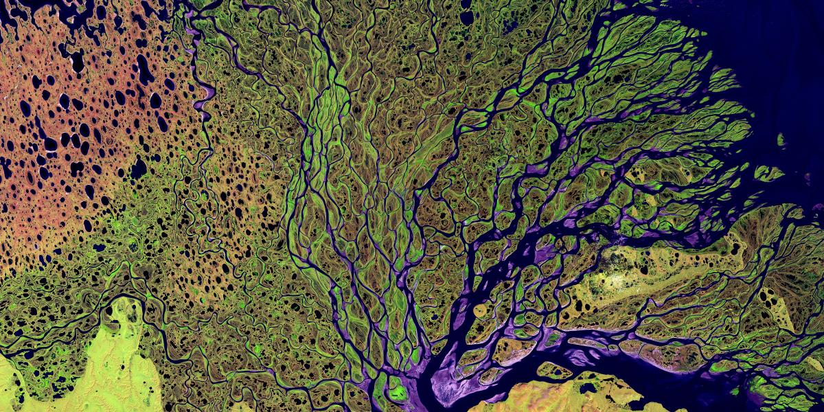
The earliest form of “remote sensing” began with aerial photography, with the first known images taken from a hot air balloon over Paris in 1858. Fast forward 100 years to 1959 and we get the first photographs of Earth taken by an orbiting satellite. In the years since those first grainy images of Earth were taken from space, rapid technological advancement has accelerated the growth of remote sensing. Today, remote sensing systems are able to capture images of and information about the Earth’s surface at an astonishingly fine scale, with some sensors even capturing images at a resolution of 0.5 meters.
.png)
One of the first images of Earth taken from space, aired on television in 1960. NASA.
Modern remote sensing systems allow us to track forest fires, detect changes in land use, create ultra-fine scale modern maps of cities, forecast weather, and so much more. Remote sensing provides us with the ability to capture a massive amount of information about Earth’s surface, making them vital tools for exploring questions we could not have approached in the past. Which begs the question, what else can we learn using remote sensing?
At emLab, many of our past and present projects leverage remote sensing data to help tackle complex challenges. In our Ocean & Fisheries program, researchers sought to use remote sensing to detect forced labor at sea. Forced labor refers to situations in which persons are coerced to work through the use of violence or intimidation, or by more subtle means such as accumulated debt, retention of identity papers or threats of denunciation to immigration authorities. Forced labor has been identified as a pervasive problem in fisheries, yet many instances of this crime go undetected due to the inherent difficulties and challenges of tracking illegal activity at sea.
Our approach to this problem leveraged two key technologies that use satellite tracking to transmit fishing vessel locations: Automatic Identification System (AIS) and Vessel Monitoring System (VMS). AIS was designed as a collision avoidance tool and is required for vessels over a certain size by international law and some smaller vessels by national regulation. VMS is a fisheries management system regulated at the national and regional level. Both systems track a vessel's movements and are meant to facilitate greater fisheries transparency.
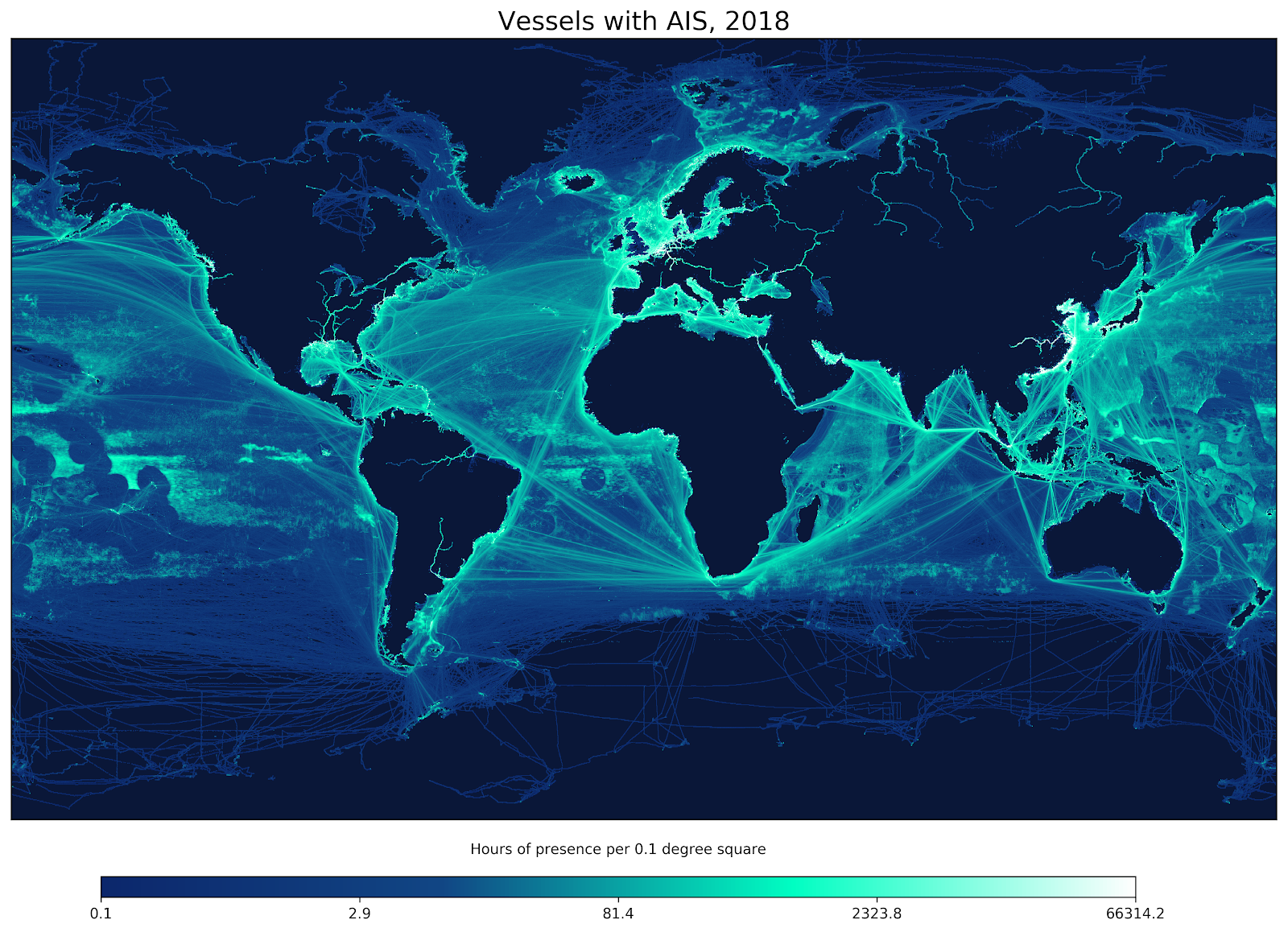
a figure depicting the tracks of all vessels transmitting AIS signals in 2018, made possible thanks to Global Fishing Watch's AIS database.
These technologies provided the infrastructure needed to detect the dynamic behavior of vessels at sea, allowing researchers to determine that vessels reported to exploit people and labor exhibited observably different behaviors than vessels that did not engage in these activities. With this revelation, researchers were able to develop a predictive model to identify vessels that might be at risk of using forced labor, based on vessel movements. Without the remotely-sensed AIS and VMS data, we could not have delivered such a crucial insight for the vulnerable communities impacted by this human rights issue.
Remote sensing can help vulnerable communities in other ways too, such as by helping to address the disproportionate impacts of climate change. In Niger, small farming communities are experiencing increased land degradation and desertification because of temperature changes and lack of rainfall, ultimately due to climate change. These communities depend on agriculture for income and food security, so developing solutions for these changes in the environment is imperative.
One technological solution to combat desertification is the construction of demi-lunes: semicircular cachements meant to trap rainwater in soil. emLab’s People & Poverty Program is in the midst of a study on the implementation of demi-lunes in villages in Niger, integrating remote sensing imagery to determine what strategies can be used to increase the uptake of demi-lunes in these communities.
This imagery is being used in combination with a randomized control trial (RCT) in which different interventions meant to increase the adoption of demi-lunes are assigned to farmers throughout the region. Researchers are able to track the adoption of demi-lunes over time using satellite imagery of the villages in the study, discerning which villages received which intervention treatment and what methods appear to be effective.
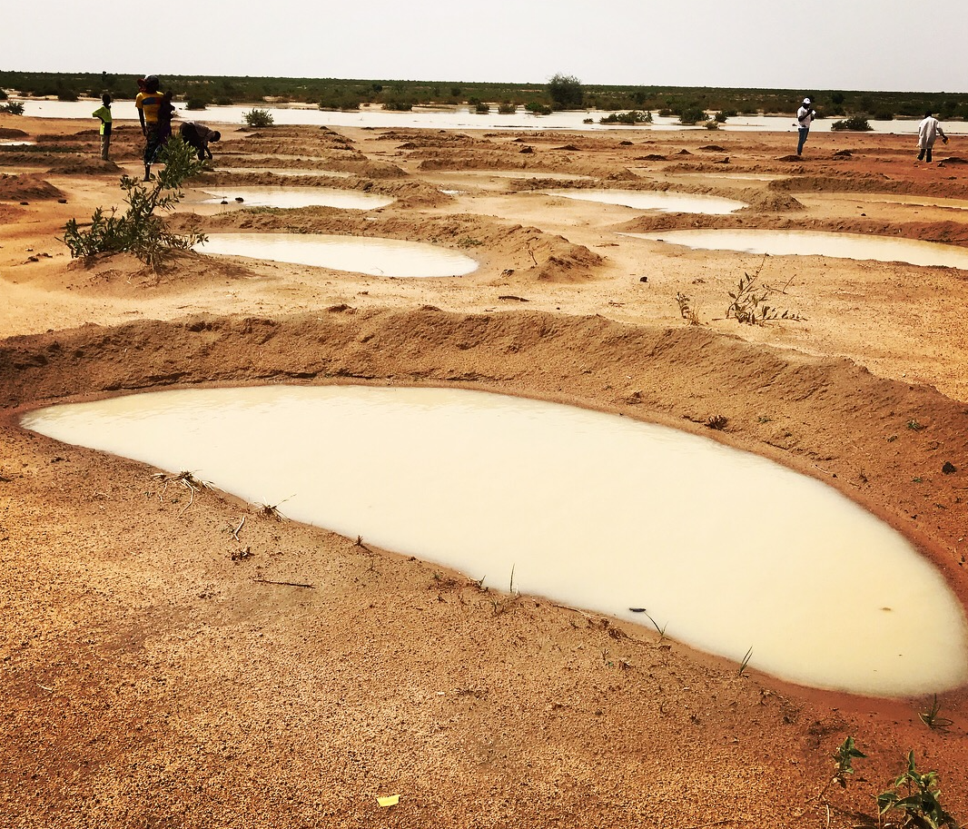
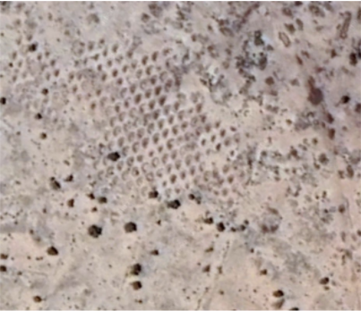
Left: a demi-lune catchment; Right: a cluster of demi-lunes as seen from satellite imagery
The remote sensing technologies used in this project allow us to assess impact with incredible precision and relatively limited resources - the alternative being expensive, time-consuming, on-the-ground surveys to track the adoption of demi-lunes across the region. The findings from this study could help provide innovative agricultural solutions to these communities now and in the future.
Remote sensing has revolutionized data collection, allowing us to track changes in the environment at an unprecedented resolution in near real-time. With the ability to observe ourselves from space, we can now answer previously impossible questions about the world around us. It has come a long way from cameras in hot air balloons, and at the exponential rate at which technology has been advancing, we will likely see even more opportunities to explore new questions with the enhanced capabilities of remote sensing in the near future.